
Garmin Zumo XT2 Motorcycle GPS inc Free pouch
0 Review(s)
Condition Beaut

Description

Garmin Zumo XT2

Garmin Zumo XT2 

Call it Sat Nav or GPS, Garmin lead the way.

The importer is having another sale. 

As usual we have trialled, tested and torn our hair out getting to grips with Garmin Zumo XT2. While it's not perfect it is the best available 'get lost box' out there. Use it hiking or in the car too if you wish.

One regular criticism is that these should come with a protective pouch. As we do, we fixed that, designing and making our own. We add a free Andy Strapz Garmin XT2 pouch with every unit bought.

Here's the Garmin blurb

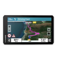
The zumo® XT2 rugged motorcycle navigator is built for adventure with a larger and brighter 6” sunlight-readable display that is built to withstand weather and handlebar vibrations.

The new visual route planner lets you customize your journey with options to choose between a thrilling ride with extra twists and turns or experiencing a more efficient route.

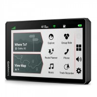
Start a group ride to track your friends on the zumo® display (requires the use of the Tread® smartphone app).

See popular moto paths and satellite imagery to find new places to explore. Afterward, share your ride details, including acceleration and deceleration.

For motorcyclists looking for the ultimate navigator, get ready to enjoy the ride.


Features:

  • NEW: ULTRA BRIGHT DISPLAY — The 6" display is 15% larger than previous models and features an even brighter HD resolution in landscape or portrait mode.
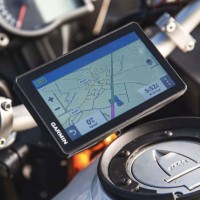
  • DESIGNED TO ENDURE — Rain? Vibration? Dust? Doesn't matter. This device is built to withstand all kinds of weather (IPX7) and rough terrain.
  • NEW: VISUAL ROUTE PLANNER — Plan a custom route on the device, or use the Tread app with a compatible smartphone.
  • SIMPLE MAP SWITCHING — Quickly toggle between on-road maps, topographic maps and satellite imagery, so you can always have the perfect map for your ride.
  • NEW: GROUP RIDE MOBILE — Use the map of your smartphone and/or zumo XT2 device to track friends with the Group Ride Mobile feature.
  • SATELLITE IMAGERY — Use satellite imagery from around the world to help you navigate. Download the maps directly to your device via Wi-Fi technology. No annual subscription is required.
  • NEW: POPULAR PATHS — See popular moto paths ridden by other riders to find new and exciting routes to explore.
  • GARMIN ADVENTUROUS ROUTING — Straight roads are boring. Find the most thrilling routes with hills, curves and sights, and choose from 4 levels of difficulty.
  • RIDE SUMMARIES — Use the Tread app to review your ride details, including speed, acceleration, decelerations, elevation and more.
  • WIRELESS UPDATES — Built-in Wi-Fi connectivity makes it easy to keep your maps and software up to date without using a computer. On- screen cues show when new updates are available.
  • LIVE TRAFFIC AND WEATHER — Access real-time traffic and weather, share routes with other riders, and get phone notifications via the Tread app.
  • INREACH COMPATIBILITY — Pair zumo® XT2 with a compatible inReach satellite communicator for two-way messaging, location sharing and, in case of emergencies, SOS capabilities.
  • BLUETOOTH CONNECTIVITY — Hear turn-by-turn directions or stream music from your compatible smartphone through a connected helmet or headset.
  • INCIDENT NOTIFICATIONS — If an incident occurs, a text message with location information is automatically sent to your predetermined contact.

Includes an Andy Strapz Zumo pouch to protect your investment valued at $42.

What's included (in the box):

  • zumo® XT2 motorcycle sat nav device
  • Motorcycle mount and hardware
  • Motorcycle power cable
  • USB cable
  • Documentation

Support Centre
https://support.garmin.com/en-US/?partNumber=010-02296-00&tab=topics

Specifications:

  • PHYSICAL DIMENSIONS: 8.8 x 15.7 x 2.4 cm
  • DISPLAY SIZE: 6-inch diag
  • DISPLAY RESOLUTION: 1280 x 720 pixels
  • DISPLAY BRIGHTNESS: ~1050 nits
  • DISPLAY TYPE: Capacitive
  • WEIGHT: 342g
  • BATTERY LIFE: Up to 6 hours (3.5 hours at 100% backlight)
  • WATER RATING: IPX7
  • TURN-BY-TURN NAVIGATION: Yes
  • 3D TERRAIN: Yes
  • TOPOGRAPHIC MAPPING: Yes
  • BIRDSEYE DIRECT SATELLITE IMAGERY: Yes
  • RIDER ALERTS: Yes
  • MAP COVERAGE: Australia and New Zealand Pre-loaded
  • VISUAL ROUTE PLANNER: Yes
  • GARMIN ADVENTUROUS ROUTING: Yes (Improved)
  • POPULAR PATHS (MOTO): Yes
  • TRENDY PLACES: Yes
  • LOCAL SPOTS: Yes
  • ECOSYSTEM FOR WAYPOINTS, TRACKS, AND ROUTE MANAGEMENT: Yes (Improved)
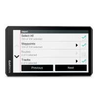
  • IMPORT & SHARE GPX FILES: Yes (Improved)
  • VIEW & SHARE RIDE SUMMARIES: Yes
  • GROUP RIDE MOBILE: Yes
  • GROUP RIDE TRACKER COMPATIBLE: Yes
  • BLUETOOTH HANDS FREE/SPOKEN DIRECTIONS HEARD: Yes
  • INCIDENT NOTIFICATIONS: Yes
  • PAIRS WITH INREACH: Yes
  • WEATHER RADAR: Via Tread app
  • SMART NOTIFICATIONS: Via Tread app
  • TRAFFIC: Via Tread app
  • MEDIA PLAYBACK AND CONTROL/MP3 PLAYER ON DEVICE: Yes

While this item is not perfect and some issues with them astound me (more on that later) they are the best option for this type of jigger. I parked my old Zumo 550 a few years ago and used Hema Explorer app on my phone. For $49 it was pretty good solution. However, in the last year the support and updates for the app have fallen by the wayside and it's getting nasty brain-fade, it's now useless for all intents and purposes. The only option was upgrading the Hema app at $100 plus a monthly subscription or bite the bullet, get over my Luddite tendancies and get a new GPS.

The brand was a no-brainer, Garmin and the best option is the Zumo XT.

All they say about it is true, glove friendly, easy to read in any light, stable and fast.

It looks well made, sealed and rugged. Like all confusion boxes, it needs patience, reading and re-reading instructions and wathcing a fair bit of youtube. I even resorted to calling Garmin Oz to get my head around a few of the weird stuff I couldn't sort out.

The downsides.

  • At a recommended retail price of $800 plus it is a serious purchase, I'd expect them to include a bag/case that would cost them $5. My Zumo 550 had a strong and useful case...in the box.
  • Unlike my old wind up 550, the XT doesn't have any form of locking system onto the cradle. The 550 had a dickie little screw device that discouraged opportunitisc theft so it didn't need to be removed each time I stop for a slash. We do have a locking device but that is another expense, weight and complication as it a key system.
  • Despite Garmin banging on about wifi enabled, if you have 5GHz wifi, system don't bother. It won't talk to it, as it's set up for 2.5 systems...doh!
  • Not bothering to come and play in the modern world, they have stuck to the same Mini USB cable as Noah used to charge his Cubit Scanner. The rest of the world uses USB C now. Another cable to cart each big ride!
  • When changing between Topo and City maps, this can only be done on a computer it is registered to, the phone app won't help here. So - the scenario of heading in a loop via the otherside of the black stump and back into civilisation will mean that if you choose Topo you won't be able to use the unit to find your mate's house in a regional city. It's one or the other. The work-around is another purchase of additional mapping via a mini SD Card to plug into the back of the unit.

Despite me sounding like I'm ready to toss it in the bin... Which I was when trying to connect it to wifi, I'll confess. As I settle into riding with it, now I understand it more, I like it. Like all computer based devices they have to be  explored and set up which takes time and patience. 



User Reviews

  • Be the first to review this product.

Please Login to add your review.